Real-Time GPS

GPS tracking powered by InstaMapper.com

Monday, April 30, 2012

Days 18, 19, 20 and 21

Good Morning Eagles


Here is our schedule from this weekend and the first few days of this week:


Starting at
Finishing at:
Day  18
Saturday, April 28
Monticello, UT
Dolores, CO
Day  19
Sunday, April 29
Dolores, CO
Telluride, CO
Day  20
Monday, April 30
Telluride Event Day

Day  21
Tuesday, May 1
Telluride, CO
Montrose, CO


Today is Monday, April 30 and day 20 of our ride   We are in Telluride, Colorado.  We are posting a few pictures from this weekend, and a special one with our quarters.  

Saturday, April 28th.... Day 18


Sunday, April 28... Day 19

Day 19... Wow
 We found our quarters too!  The bike is called "The Rattler" by it's rider who is on our team.  This picture is made by using a special computer program.  We added new wheels.... the quarters... from all the states we have travelled through. 

We liked this sign.  Share the road.


Have a great day!
Your friends,
The Ride for World Health Team


Friday, April 27, 2012

Days 17, 18, 19 and 20

Good Morning Eagles

This is our schedule.  Thank you for the good questions and for all the kind words to support us.


Starting at:
Finishing at:

Day 17
Friday, April 27
Natural Bridges National Monument, UT
Monticello, UT
Day 18
Saturday, April 28
Monticello, UT
Dolores, CO
Day 19
Sunday, April 29
Dolores, CO
Telluride, CO
Day 20
Monday, April 30
Telluride Event Day


Link for Natural Bridges National Monument http://www.nps.gov/nabr/index.htm

Owachomo Bridge

Today we are leaving the Natural Bridges National Monument in Utah.  We are still in Utah and are near three other states.  We are near Colorado, Arizona and New Mexico.  Colorado is the next state we will ride through.

Oswalt Eagle loves all the beautiful rock formations.

We have lots and lots of maps.  We have maps on our computers, on our phones, and paper maps.  We learned to read maps in school.  One of our riders has InstaMapper on her phone.  The map on the computer updates and moves when her phone has a signal.  We do not have a signal when we are too far from a phone cell tower, like when we are in the desert or mountains.

Sometimes we get tired, and we take a little break.  We have some fluids and food and off we go.

When we do not have the internet, or phone service, or TV, then we get a paper and read.


The Oswalt Eagle travels with us to encourage us.  We know that you are thinking of us and we appreciate your support.  We encourage each other too.  We can do it!!  Washington, D. C.  on day 53!!!

We are being safe as possible.  Yesterday we had to stop riding because it started lightening.  We have trained hard and the altitude makes riding harder but we are doing well.


Talk to you soon, riding onward.... Ride for World Health Team

Tuesday, April 24, 2012

Days 14, 15, 16, and 17

Good Morning Eagles

Yesterday we climbed a big mountain.

     Looking up at the mountain, drinking lots of fluids along the way and  looking down from the top of the mountain.


This week we will ride through Utah.  Here is our plan.


Starting at:
Finishing at:
Day 14
Tuesday
April 24

Tropic, UT
Boulder, UT
Day 15
Wednesday
April 25

Boulder, UT
Hanksville, UT
Day 16
Thursday
April 26

Hanksville, UT
Natural Bridges National Monument, UT
Day 17
Friday
April 27

Natural Bridges National Monument, UT
Monticello, UT


This link should show you where we are.  Hope you can find us.  Have a good day,
The Ride for World Health Team
http://www.instamapper.com/ext?key=4569109704441438931

Monday, April 23, 2012

Day 13 Cedar City, UT to Tropic, UT
Good morning Eagles!
Monday, April 23, 2012
Starting Point: Cedar City, UT
Ending Point: Tropic, UT

Route Distance: 95 miles
Route Description:  Around mile 17 we will start climbing a mountain that is our steepest and most difficult mountain. At around mile 25,  we enter into Dixie National Forest  where we will ride along Panguitch Lake for a bit. After this we then ride through the northern part of Bryce Canyon National Park to Tropic.


Oswalt Eagle found out we have a back pocket on our jerseys.
 This link should show you where we are.  Hope you can find us.  Have a good day,
The Ride for World Health Team

http://www.instamapper.com/ext?key=4569109704441438931


Day 8 through Day 12.. 
Hello to our friends at Oswalt...
Thank you for taking the time to blog with us.  We are riding hard most days.  We do not always have the internet, so please do not worry if we don't answer every day.  We think of you each day as we travel with the Oswalt Eagle.
Oswalt has his sunscreen on.
 Day 8:  Las Vegas

We are medical students right now.  We will go through a ceremony at The Ohio State University Medical School in Columbus, Ohio on June 7, 2012.  We will receive a long white coat with our names on it.  We will be officially doctors then.

This picture was taken on day 8 of our ride.  Our schedule is to end our trip on day 54, June 3, 2012 by going from Washington, D.C. to Bethany Beach, DE. 

We will let you know about our Washington, D.C. plans when we get closer to that day.

We must be back in Columbus, Ohio for our ceremony on June 7, 2012.


We do laundry many ways.  Some days we  wash our clothes in the sink and drying them using a rope for a clothesline.  In Las Vegas, the Oswalt Eagle came with us to the laundromat.  We ask the local people where we can find places to wash our clothes and they are very helpful.  We have fun even when we are working.
  
Day 9:  Las Vegas, NV to Alamo, NV
Day 9:  Thursday, April 19, 2012
Starting Point: Las Vegas, NV
Ending Point: Alamo, NV
Route Distance: 83 miles
Route Description: We will depart from north Las Vegas and head North for most of the day. It will be a hard day with a lot of climbing. Around mile 75 we enter into Pahranagat National Wildlife Refuge.

Anyone seen the Oswalt Eagle?


Day 10:  Alamo, NV to Panaca, NV
Day 10:  Friday, April 20, 2012
Starting Point: Alamo, NV
Ending Point: Panaca, NV
Route Distance: 71 miles
Route Description: Today we ride eastward across Nevada. Most of the day will be spent riding along US Route 93, also known as the Great Basin. 

It is a relatively short ride though we do have one big climb starting halfway through the ride. Then we have a gentle climb into Panaca, which was southern Nevada's first permanent settlement and was founded as a Mormon colony in 1864.


Oswalt Eagle reaches the summit!

Day 11 and 12:  Panaca, NV to Cedar City, UT
Day 11:  Saturday, April 21, 2012
Starting Point: Panaca, NV
Ending Pont: Cedar City, UT
Route Distance: 79 miles
Route Description: Today will be our last day in Nevada. Right after leaving Panaca we start a big climb. Luckily, after we make it over, the rest of the day is mostly flat. At about mile 20 we will cross into Utah, the Beehive State!


Day 12:  Sunday, April 22, 2012  We plan a rest day, but we will need to shop, do laundry again, and do our other work.  We will plan to ride again on Monday to Tropic, Utah.


Work hard and play hard. Our team celebrates!


Lisa had her birthday in San Diego.  Her brothers and father were riders for day 1-8.


If someone has a birthday then we celebrate our birthdays together.  We have fun even when we are working hard. 

We hope you will work hard in school, that you are eating healthy and that you are exercising each day.  Thank you for all your kind and encouraging words.  The hills and mountains are very big, and the wind is very strong.           

Ride for World Health 2012 Team

Thursday, April 19, 2012

Hello Oswalt Eagles!!

I am very sorry that you haven't heard from us in a few days. We have been very busy biking across the desert in California. Most of the places that we have stayed are very small, and we did not have internet. Here is where the Oswalt Eagle has been since you last heard from us!

Day 3:  Walnut to Hesperia.  We left Oswalt on our way to Hesperia.  We had too much rain and lightening to ride safely so we had to end the day early and ride in the vans, but we saw a rainbow along the way.
 
Our rainbow from the vans
 Day 4:  Hesperia to Barstow

Ben, Chris, Blair, and Nicole at the Barstow Fire Department where we stayed
Barstow: 
Population was 22,639

Barstow is home to Marine Corps Logistics Base Barstow and is the closest city to Fort Irwin Military Reservation.


The settlement of Barstow began in the late 1840s in the Mormon CorridorPeople, goods and animal herds would move from New Mexico and Utah to Los Angeles, along the Old Spanish Trail from Santa Fe, or from Salt Lake City along the Salt Lake Road.


Barstow is named after William Barstow Strong.


Day 5:  Barstow, CA to Kelso, CA
Route 66 - the road we took across California
One of the original U.S. Highways, Route 66 was established on November 11, 1926. The highway, which became one of the most famous roads in America, originally ran from Chicago,Illinois, through MissouriKansasOklahomaTexasNew MexicoArizona, and California, before ending at Los Angeles, covering a total of 2,448 miles.

We rode the historic Route 66 from Barstow to Kelso. It was a very very long day. We each rode our bikes for 92 miles, and climbed up 4,000 feet. 


We had about 30 flat tires in one day.


Oswalt eating a chicken sandwich at Dairy Queen. Is this a healthy choice?? What would be a better choice?


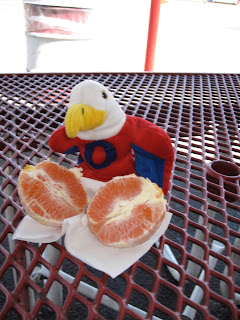
Oswalt eating an orange. Fruit is very filling and very healthy. 
 Day 6:  Kelso, CA to Shoshone, CA

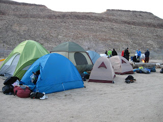
Mojave National Preserve is where we stayed while we were in the desert and this is our campsite.

Day 7:  Shoshone, CA to Las Vegas, Nevada


The laundromat where we are at in Las Vegas, cleaning our clothes. 

Day 8:  Las Vegas, Nevada

We thought we could rest today, but realized we had work to do.  We washed clothes, shopped and did all the internet work we had been unable to do for the last few days.

Day 9:  Las Vegas, Nevada to Alamo, Nevada.

We are leaving Las Vegas today.  We might not be able to post each day, but we are keeping Oswalt's Eagle safe as we travel together across America.